Printable Version of Topic
Click here to view this topic in its original format
914World.com _ Past Event Planning Threads _ Twisty tour
Posted by: Doug Leggins Oct 5 2006, 03:38 PM
I have been driving around the backroads of the county scouting out a twisty tour. I have come to the conclusion that the original route that Sean mapped out for the first FFC covers some of the best roads for the tour ---Good job Sean! Only a few changes are required to meet this year's plan. I found one of the original maps that was provided at the event and I really like the detail. I need to generate maps to give to the group. The original map looks similar to what I can pull up using Google maps, but I cannot get a large enough view.
Sean - How did you get the original map?
Anybody else have a good map program?
Posted by: Pnambic Oct 5 2006, 03:42 PM
I've got Microsoft Streets and Trips.
Posted by: Moron Sean Oct 5 2006, 04:40 PM
I think I used Mapquest and did segments, then pieced it together.
I'll see if I have the original file that I used with me.
Posted by: Moron Sean Oct 5 2006, 04:53 PM
Nope, I lied. I bought a map/atlas of Indiana at KMart and scanned Southern Indiana scanned it and pieced it together.
I do have the original scans, but the file is VERY LARGE. I'll see if I can make a smaller version that you could use to show the changes. I could then make them and send you a finished map to print.
Attached thumbnail(s)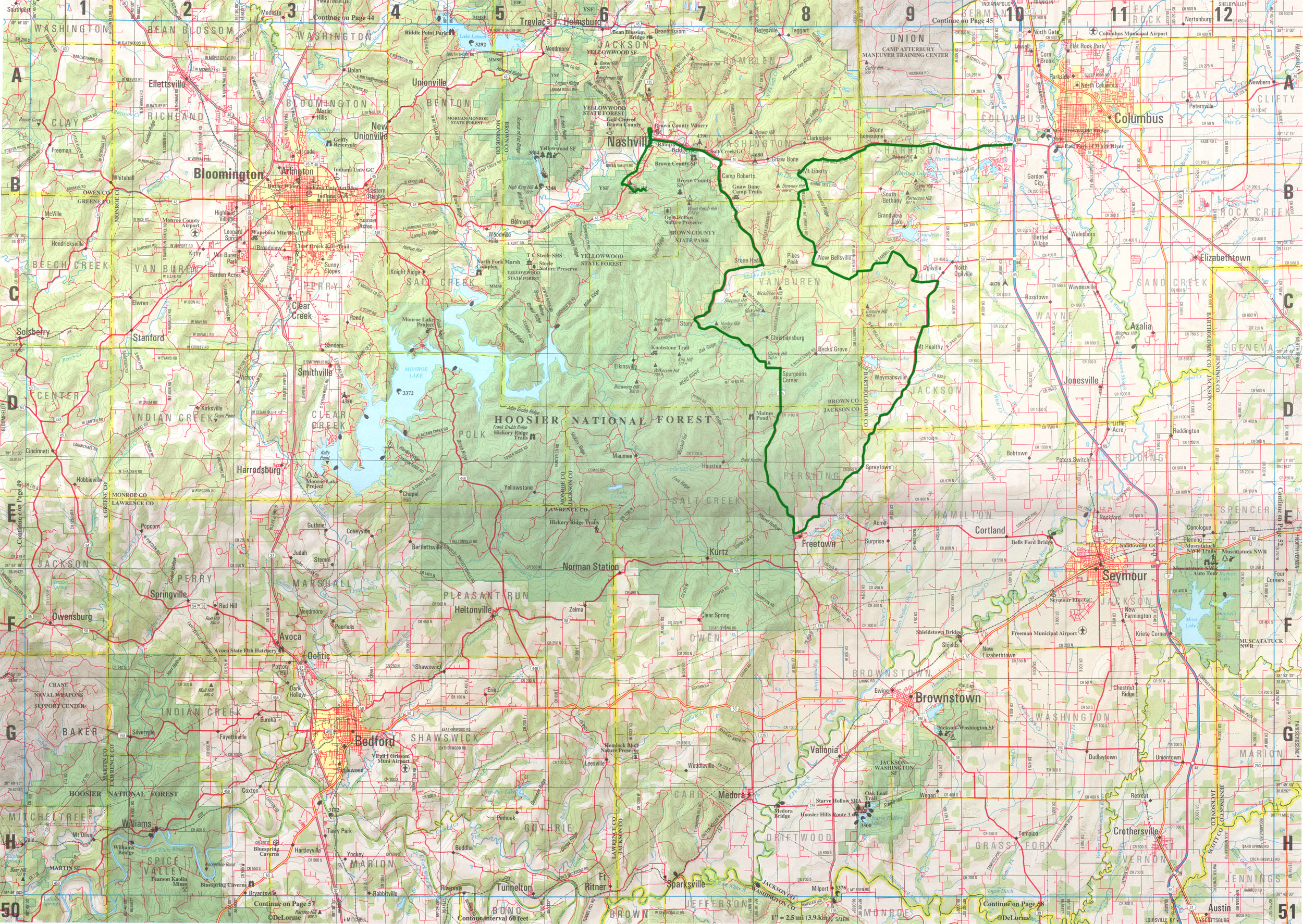
Posted by: Doug Leggins Oct 5 2006, 07:26 PM
Where did you get the milage between points info? Drive and jot it down, or off of a website?
Posted by: Moron Sean Oct 5 2006, 10:55 PM
I drove it and wrote everything down as I did it.
Powered by Invision Power Board (http://www.invisionboard.com)
© Invision Power Services (http://www.invisionpower.com)