|
|
|
Porsche, and the Porsche crest are registered trademarks of Dr. Ing. h.c. F. Porsche AG.
This site is not affiliated with Porsche in any way. Its only purpose is to provide an online forum for car enthusiasts. All other trademarks are property of their respective owners. |
|
|

  |

| Doug Leggins |
 Oct 5 2006, 03:38 PM Oct 5 2006, 03:38 PM
Post
#1
|
|
Senior Member  Group: Benefactors Posts: 1,358 Joined: 6-February 03 From: Nashville, Indiana Member No.: 261 Region Association: None |
I have been driving around the backroads of the county scouting out a twisty tour. I have come to the conclusion that the original route that Sean mapped out for the first FFC covers some of the best roads for the tour ---Good job Sean! Only a few changes are required to meet this year's plan. I found one of the original maps that was provided at the event and I really like the detail. I need to generate maps to give to the group. The original map looks similar to what I can pull up using Google maps, but I cannot get a large enough view.
Sean - How did you get the original map? Anybody else have a good map program? |
   |

 
|
| Pnambic |
Oct 5 2006, 03:42 PM
Post
#2
|
|
Honk if you like obscene gestures! Group: Members Posts: 914 Joined: 9-April 03 From: Atlanta, GA Member No.: 546 Region Association: South East States |
I've got Microsoft Streets and Trips.
|
|
|
|
| seanery |
Oct 5 2006, 04:40 PM
Post
#3
|
|
waiting to rebuild whitey! Group: Retired Admin Posts: 15,852 Joined: 7-January 03 From: Indy Member No.: 100 Region Association: None |
I think I used Mapquest and did segments, then pieced it together.
I'll see if I have the original file that I used with me. |
|
|
|
| seanery |
Oct 5 2006, 04:53 PM
Post
#4
|
|
waiting to rebuild whitey! Group: Retired Admin Posts: 15,852 Joined: 7-January 03 From: Indy Member No.: 100 Region Association: None |
Nope, I lied. I bought a map/atlas of Indiana at KMart and scanned Southern Indiana scanned it and pieced it together.
I do have the original scans, but the file is VERY LARGE. I'll see if I can make a smaller version that you could use to show the changes. I could then make them and send you a finished map to print. Attached thumbnail(s) 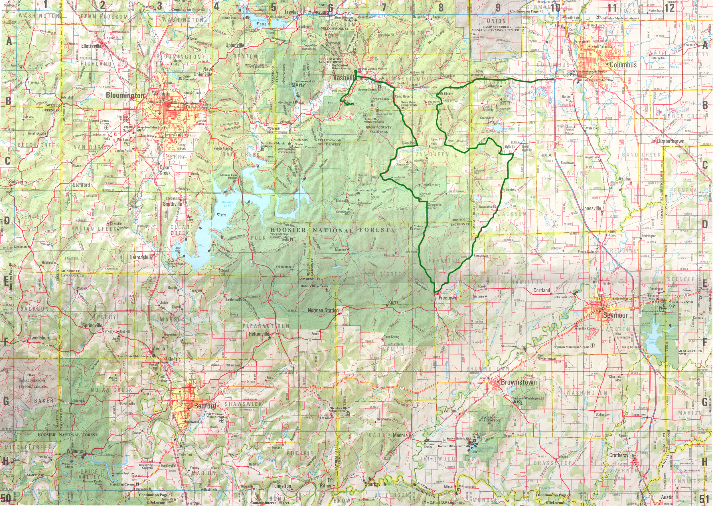
|
|
|
|
| Doug Leggins |
Oct 5 2006, 07:26 PM
Post
#5
|
|
Senior Member Group: Benefactors Posts: 1,358 Joined: 6-February 03 From: Nashville, Indiana Member No.: 261 Region Association: None |
Where did you get the milage between points info? Drive and jot it down, or off of a website?
|
|
|
|
| seanery |
Oct 5 2006, 10:55 PM
Post
#6
|
|
waiting to rebuild whitey! Group: Retired Admin Posts: 15,852 Joined: 7-January 03 From: Indy Member No.: 100 Region Association: None |
I drove it and wrote everything down as I did it.
|
|
|
|
|
1 User(s) are reading this topic (1 Guests and 0 Anonymous Users)
0 Members:

|
Lo-Fi Version | Time is now: 14th May 2024 - 03:38 PM |
Invision Power Board
v9.1.4 © 2024 IPS, Inc.